所屬科目:奧林匹亞地理
Based on the information in this picture, in which direction away from Amsterdam was this plane flying? (A) North (B) South (C) East (D) West
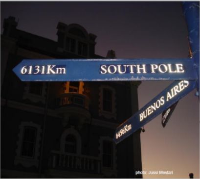
Where was this picture taken? (A) 35 °S in Africa (B) 35 °S in Australia (C) 60 °S in South America (D) 60 °N in Europe
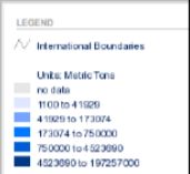
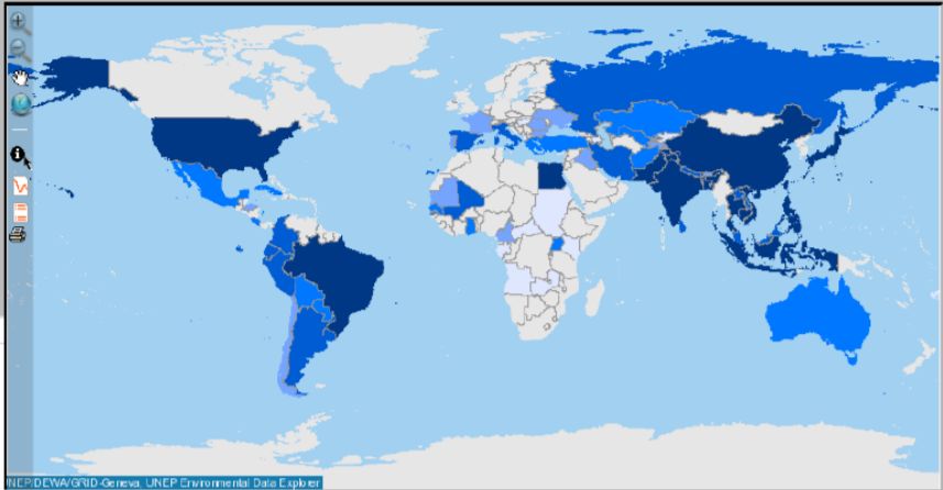
The map shows worldwide production of (A) Grapes (B) Wheat (C) Rice (D) Cotton
What is the main rock of this landform? (A) Basalt (B) Tuff (C) Limestone (D) Granite
Which of the figures explains the phenomenon of clouds in the mountains as shown on the photograph? A, B, C or D ?(A)(B)(C)(D)
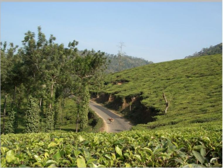
Which two islands are main areas of cultivation for the depicted crop: (A) Sri Lanka and Java (B) Midway and Mauritius (C) The Azores and Sumatra (D) Hokkaido and New Guinea
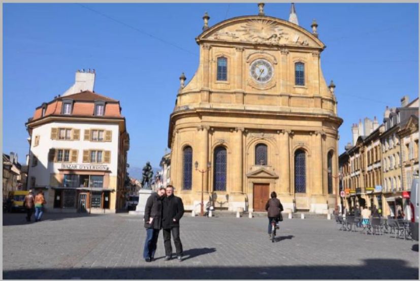
The picture shows Yverdon-les-Bains in Switzerland (46 °46.71′ N and 6 °38.45′E). It was taken on 21th March 2012. In which direction in the cyclist heading? (A)ESE (B)WNW (C)ENE (D)WSW
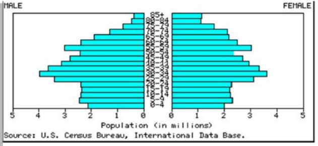
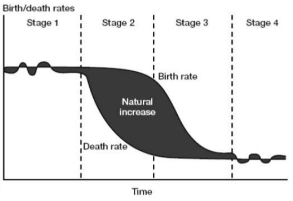
With what stage of the demographic transition does this population histogram correspond? (A) Stage 1 (B) Stage 2 (C) Stage 3 (D) Stage 4
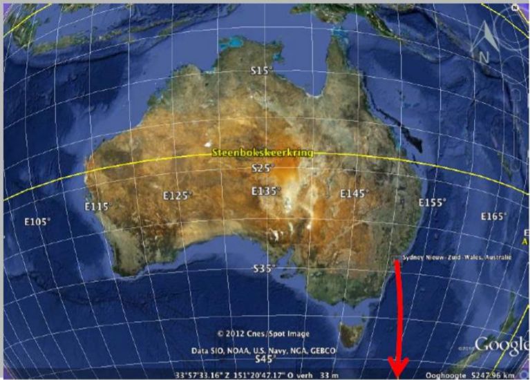
We leave Sydney in the indicated direction. Which city will we reach after 32.200 km: (A) Singapore (B) Paris (C) Tokyo (D) New York
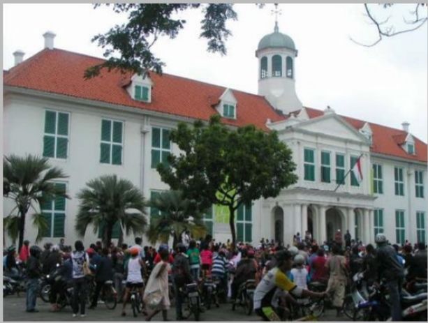
The photo shows a building in Jakarta constructed by the Dutch. Remnants from colonial times can still be seen in many countries. For which country is this not true? (A) Thailand (B) Canada (C) Laos (D) Libya
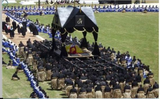
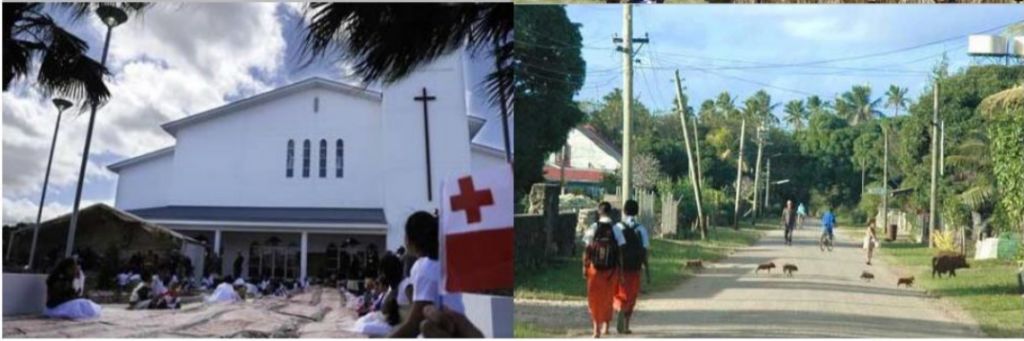
In what country were these photos taken? (A) Cape Verde (B) Cuba (C) Tonga (D) Sri Lanka
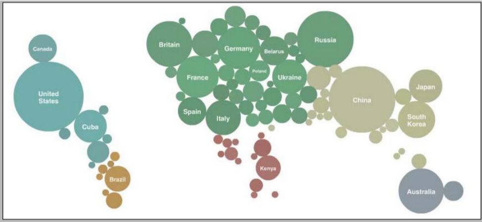
What does this world map show the distribution of? (A) Total number of internet connections (B) Medals won at the 2010 Beijing Olympics (C) Total numbers of tourist arrivals (D) Number of dentists per thousand population
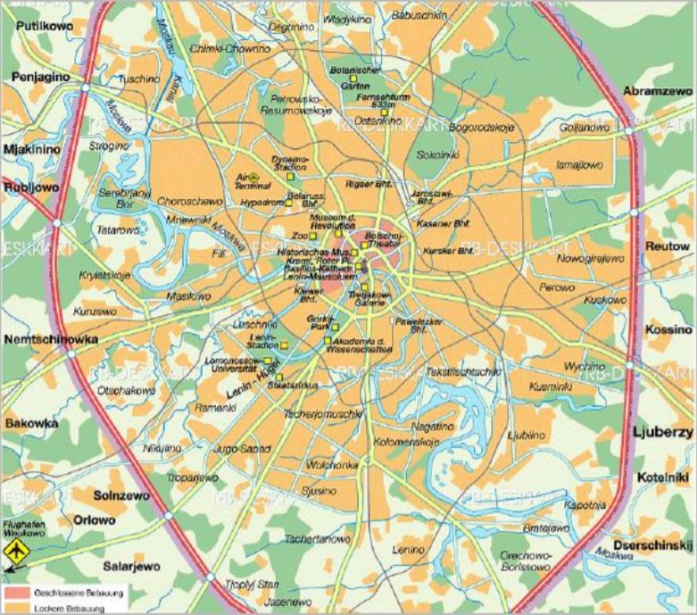
Which city has the same type of road network as Moscow?(A) Kyoto (B) Cairo (C) Paris (D) Chicago
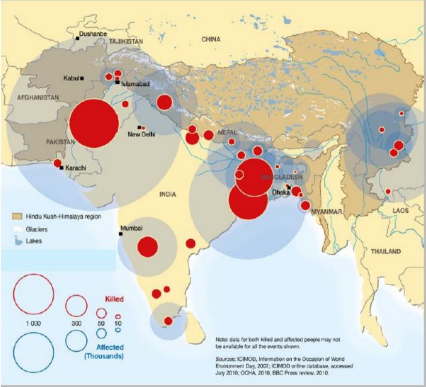
Red/blue circles on this map indicate the location of severe damage caused by a type of natural hazard in 2008- 2010. This hazard was: (A) Earthquakes (B) Mud flows (C) Floods (D) Tsunamis
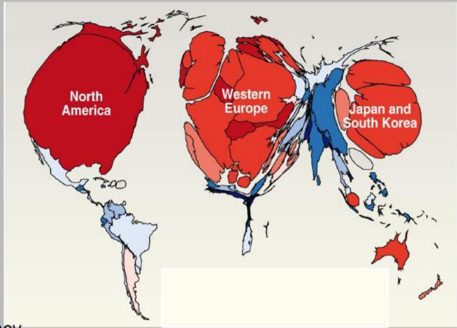
This early 21st century world map shows the geographical distribution of : (A) Average life expectancy (B) GDP (Gross Domestic Production) (C) Literacy (D) Primary education
Which words are missing in the text below? (A) 1 = climate change and 2 = is not broken down (B) 1= wave pattern and 2 = accumulates (C) 1 = rotation of the earth and 2 = accumulates (D) 1 = distance to the equator and 2 = is not broken down The oceans are dynamic systems, made up of complex networks of currents that keep water circulating around the World. The direction of the currents is determined by wind, variations in water density and ........................(1). Sometimes this creates ocean currents that take on enormous circular motion. These are called gyres. Due to the deflection of ocean currents at the centre of the gyre, plastic debris ................................... (2).
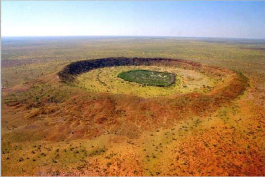
The central feature in this photo was formed by: (A) Erosion of a ring dyke (B) Impact of a meteorite (C) Volcanic eruption (D) Uplift of a concave slope
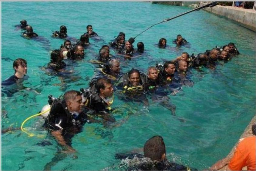
The Cabinet of which island country held an underwater meeting to draw attention to the threat of rising sea level submerging their country? (A) Maldives (B) Fiji (C) Malta (D) Iceland
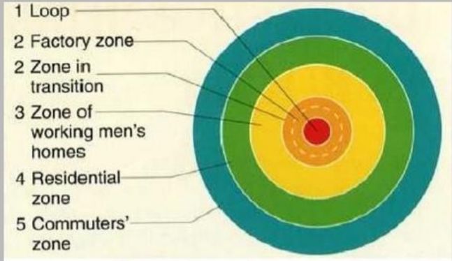
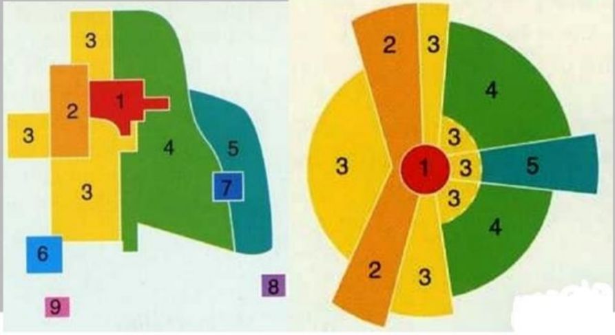
Here are three models characterizing the development of urban processes. This reduction of complexity allows an easier analysis of urban forms. Look carefully. Which name does not refer to one of these three models? (A) Concentric model (after Burgess) (B) Sector model (after Hoyt) (C) Multiple nuclei model (after Harris and Ullman) (D) Multiple segment model (after Lloyd)
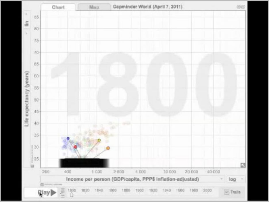
Which country’s data makes the blue line? (A)Spain (B)Indonesia (C)Ecuador (D)Botswana
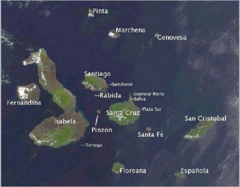
This satellite picture shows the volcanic Galapagos Islands. Which of the following statements is correct? (A)The island of Isabela is older than Santa Fé. (B)The island of San Cristobal is younger than Fernandina. (C)The island of Isabela is younger than the island of Espanola. (D)The island of Espanola is younger than the island of Isabela.
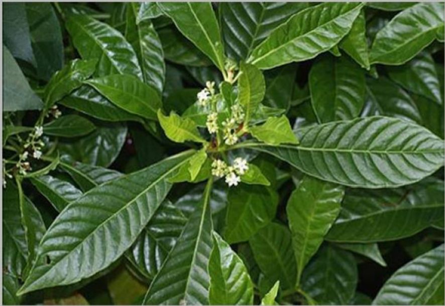
Which natural product is native to Ethiopia, but was a commercial success in South America? (A) Coffee (B) Cocoa (C) Orange (D) Tea
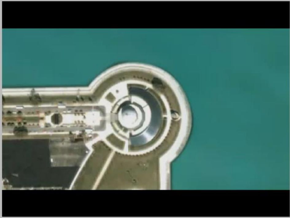
This film zooms out from which city? (A)Chicago (B)Montreal (C)New York (D)Toronto
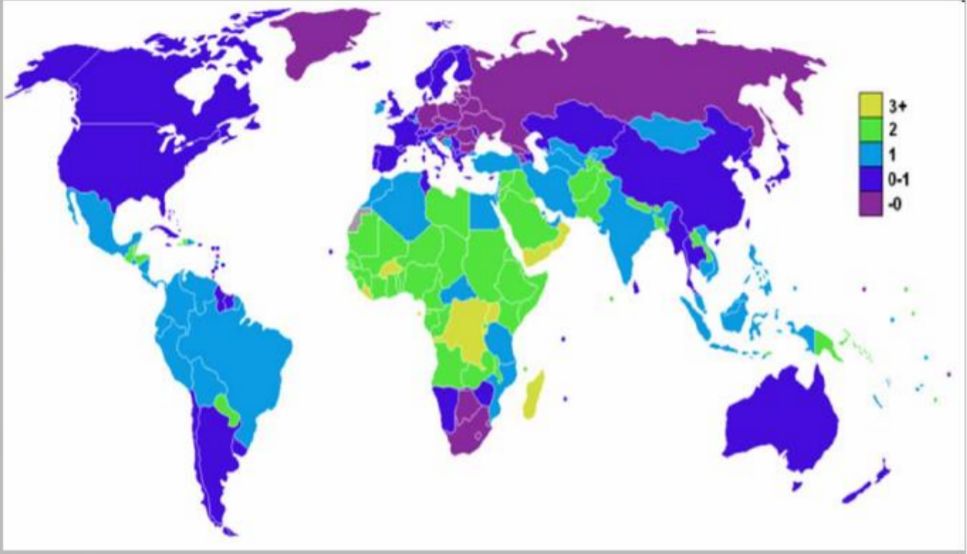
The map shows a population growth rate of over 2% for Sub-Saharan Africa. What is the reason for the zero growth rate in South Africa? (A) Improved level of education (B) High standard of living (C) HIV pandemic (D) Climate change
Forest fires in Mediterranean countries like Portugal are often caused by: (A) Strong winds coming from the Atlantic Ocean (B) People who set fire to areas on purpose or accidentally (C) Spontaneous ignition when there is a combination of high temperatures and dry weather in the summer (D) Sparks coming from passing cars
On Saturday June 30th, 2012, UNESCO condemned the destruction of three sacred tombs by Islamic militants who said they would destroy more. In which country was this destruction? (A) Niger (B) Chad (C) Mali (D) Yemen
In which city was this photo taken? (A) Chicago (B) Miami (C) New Orleans (D) San Francisco
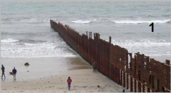
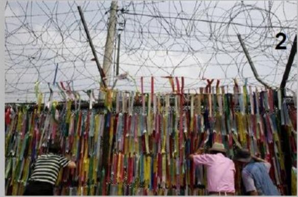
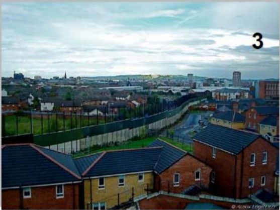
Walls and fences are everywhere in the world. Where were these pictures taken? (A) 1 = Belfast, 2 = Tijuana, 3 = Paju (B) 1 = Paju, 2 = Tijuana, 3 = Belfast (C) 1 = Paju, 2 = Belfast, 3 = Tijuana (D) 1 = Tijuana, 2 = Paju, 3 = Belfast
 阿摩線上測驗
登入
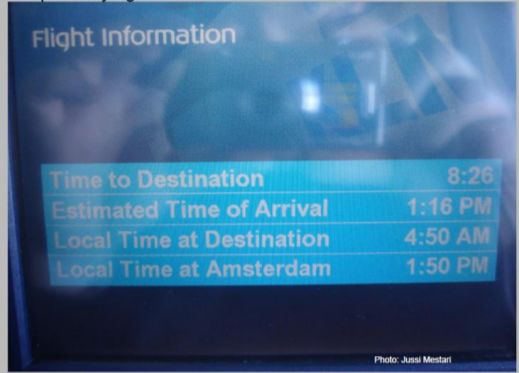 (A) North (B) South (C) East (D) West
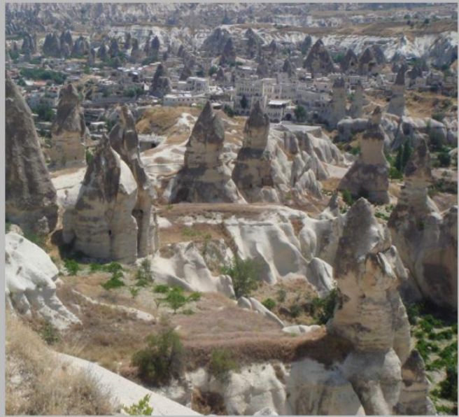 (A) Basalt (B) Tuff (C) Limestone (D) Granite
 (A)
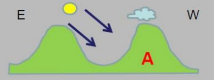 (B)
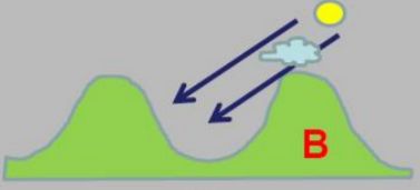 (C)
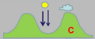 (D)

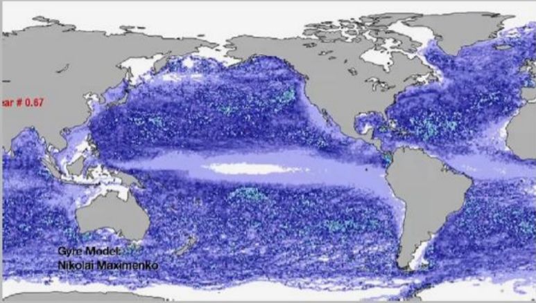 The oceans are dynamic systems, made up of complex networks of currents that keep water circulating around the World. The direction of the currents is determined by wind, variations in water density and ........................(1). Sometimes this creates ocean currents that take on enormous circular motion. These are called gyres. Due to the deflection of ocean currents at the centre of the gyre, plastic debris ................................... (2).
 (A) Niger (B) Chad (C) Mali (D) Yemen